


September 2023
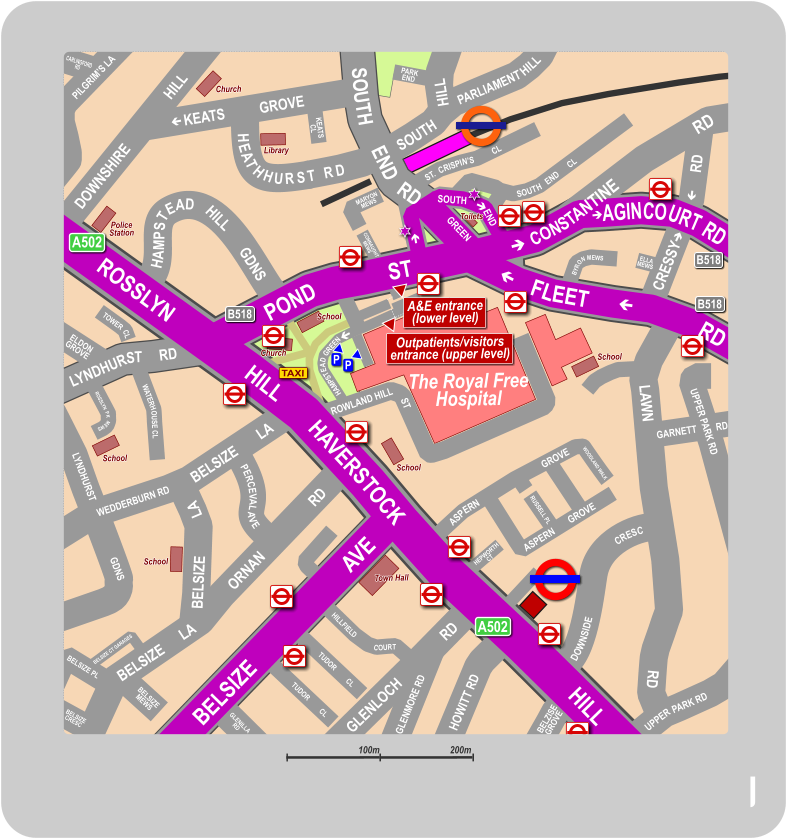
Map of The Royal Free Hospital
Hampstead with Transport Connections


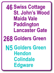
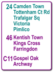
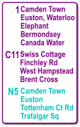
Stop A