
comprehensive public transport maps for London communities
local area bus route maps
London Local Maps can be created for web or print use, show office, retail or venue locations,
have venue information attached to locations, show “how to get to” information and other
dynamic content, as required.
Prices for custom maps are relative to the size of the map, the level of detail, file formats and
dynamic content required. Maps for charities and non-profit organisations may be free.
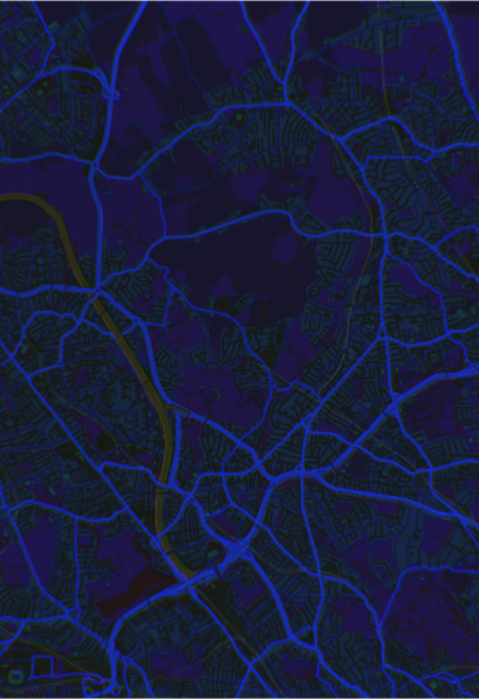
London Local Areas Public Transport Maps are specially made to include all
modes of public transport available in an area: Train and Underground Lines
and all Bus and Coach Routes, showing all stations, bus stops and available
connections and destinations, with time table information attached (if available).
All maps are geographical (not diagram or “spider”) and aim to be as correct as
possible.
Currently available are a number of local London town centre and area maps,
individual bus route maps, train and river transport maps and also larger areas.
New maps are being added all the time and existing ones are regularly updated.

Other London Transport Maps include London Overground, DLR and Croydon
Tramlink maps with bus interchange information, Thames river transport,
individual bus route and cycle route maps, venue maps with programme links, as
well as black-and-white maps in print resolution.

www.londonlocalmaps.com
Click on the List of Maps above for the entire catalogue. Areas
covered include Barnet, New Barnet, Enfield, Edgware,
Colindale, Wood Green, Harringay, Hornsey, Wembley,
Wembley Park, Brent Park, Neasden, Harlesden, Park Royal,
North Acton, Brent Cross, Hendon, Lisson Grove, St. John’s
Wood, Swiss Cottage, Bermondsey, Primrose Hill, Camden
Town, Finsbury Park, Islington, Aldgate, Bank, Spitalfields,
Tower Hill, St. Paul’s, Blackfriars, Bow, Hackney Wick,
Stratford, Leyton, Canning Town, Silvertown, West Beckton,
North Woolwich, Woolwich, Charlton, Greenwich, North
Greenwich, Blackheath, Westminster, St. James’s, Mayfair,
Belgravia, Knightsbridge, Brompton, Chelsea, Kensington,
South Kensington, Bayswater, West Kensington, West
Brompton, Earl’s Court, Hammersmith, Baron’s Court, Parsons
Green, Fulham, Putney, Putney Heath, Southfields,
Wimbledon, Wimbledon Park, Kingston, Surbiton, Teddington,
Hampton Wick, Hampton Court, Thames Ditton, Long Ditton
and others, inluding all London and other bus routes, coach
routes, private bus routes, rail, Underground and Overground
lines, DLR, Trams, River Buses, canal boats, cable car, cycle
hire stations, foot and cycle paths, taxi ranks and places of
interest.